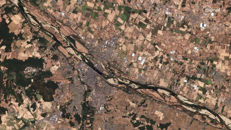
INFOGRAPHIES. Loire, Rhin, Danube, Pô... les images satellites des fleuves assoiffés par la sécheresse
✨ AI Summary
🔊 جاري الاستماع
تحليل ذكي | AI Editorial Analysis
•Entre une saison estivale qui a battu des records de chaleur et la faiblesse des pluies, de nombreux cours d'eaux français sont à sec ou connaissent des ruptures d'écoulements.
•L'intensité de la sécheresse est particulièrement notable et son ampleur est d'autant plus visible sur les images satellites.
هذا الخبر من BFM TV. خبر يقدم أدوات ذكاء اصطناعي للتلخيص والترجمة والاستماع.
Entre une saison estivale qui a battu des records de chaleur et la faiblesse des pluies, de nombreux cours d'eaux français sont à sec ou connaissent des ruptures d'écoulements. L'intensité de la sécheresse est particulièrement notable et son ampleur est d'autant plus visible sur les images satellites.
المصدر: BFM TV
| Source: BFM TV
ملاحظة تحريرية | Editorial Note: نُشر هذا المقال في الأصل بواسطة BFM TV. خبر (Khabr) هي منصة إعلامية أردنية مرخّصة تعمل بالذكاء الاصطناعي. نضيف قيمة تحريرية من خلال: تحليل ذكي للأخبار، ملخصات تلقائية، رواية صوتية بالذكاء الاصطناعي، ترجمة متعددة اللغات، وتدقيق الحقائق. هدفنا جعل الأخبار أكثر وضوحاً وسهولةً للقارئ العربي.
This article was originally published by BFM TV. Khabr is a licensed Jordanian AI-powered news platform (Registration #82086). We add editorial value through: AI-powered news analysis, automated summaries, AI audio narration, multi-language translation (Arabic, English, French, Turkish), and AI fact-checking. Our mission is to make news more accessible and understandable for Arabic-speaking audiences worldwide.